Follow one of the many walking tracks and see more of the distinctive and varied scenery or venture into wonderful tussock landscapes and clear blue skies.
Download our Tracks and Trails Info Sheet
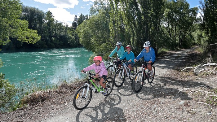
Alexandra-Clyde 150th Anniversary Walk (River Track) - Start in Clyde or Alexandra and follow the Clutha River for 12km. This easy cycle or walk trail is suitable for the whole family. Mainly flat with one or two boardwalks and bridges nearer Alexandra, this good surfaced trail is special no matter the season, although can be closed for periods during times of high river flow. Gold was discovered around 1862. The best time to recover the gold was when the Clutha River was at it's lowest which was in the freezing winter time. When the easy gold ran out the miners switched to sluice boxes then on to Spoon dredges then Wheel dredges. In 1920 there were 20 dredges working on the Clutha River between Alexandra and Clyde.
Butchers Dam - Walk around Butchers Dam, where native species grow in the driest of conditions. The area includes historical evidence of European and Chinese settlement.

Located 6 km south of Alexandra on SH8. Turn left into the access to Butchers Dam. Access to Flat Top Hill Conservation Area is via an easement over private land and consent from the Last Chance Irrigation Company to use the dam crest. Respect the adjoining private property. Dogs must remain on a leash until in the Conservation Area. Foot and mountain biking only.
Alexandra Clock - A short walk across the historic Shaky Bridge up to the Alexandra Clock, a timepiece that has served Alexandra since 1968.
The Shaky Bridge, completed in 1879 was built to provide a link between the growing town and the hinterland to the east of the Manuherikia and Clutha Rivers. A set of stone towers stand on either side of the bridge, with the suspension wires arching between them. The approaches to the bridge are built up in stacked stone.

Cross the Bridge and follow the track up to the Alexandra Clock where a stunning view of Alexandra awaits.
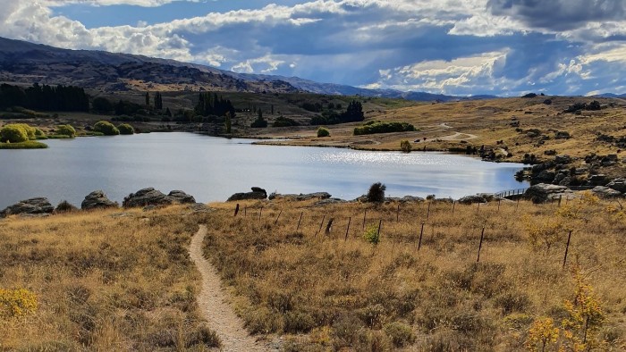
Sutton Salt Lake - New Zealand's only inland salt lake, with water about half as salty as seawater. With no outlet, Sutton Salt Lake has concentrated salts from surrounding soils as it has repeatedly filled, evaporated and refilled.
Nestled amongst the spectacular parallel rock tor ridges of Sutton, with a backdrop of the Rock and Pillar Range, the lake (approximately8 ha) occupies an enclosed shallow basin in the schist rock landscape.

Salt tolerant herbs and grasses occupy the lake margins, although in a dry summer the lake dries up completely, only to refill again during the winter. A range of water birds and waders use the lake, feeding on the tiny salt-adapted aquatic animals, including copepods, rotifers and water beetles.
Enjoy the loop walk around the lake, it will take 40 - 60 minutes and is described as easy. Dogs are not permitted.
Naseby Trails - some of the best walking and biking terrain in New Zealand. The Forest Recreation Area covers more than 500 ha. Access is free for personal recreational use; however entry is only permitted during daylight hours and subject to fire danger levels and logging operations.

Within the Recreation Area, the Forestry Company Ernslaw One maintains approx. 50 km of tracks. There are picnic areas, a children’s playground, historic gold mining sites and two dams for fishing and swimming. Toilets are provided at the Coalpit Dam; these are drained and closed up during the winter months.